新的BaseMap
支持两个新的底图类型:Terrain和Dark Gray。Dark Gray在ArcGIS Online上是一个全新的底图。
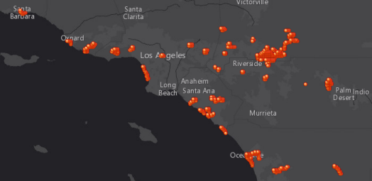
更新HeatmapRenderer
HeatmapRenderer类不再是Beta版本了,对该类的构造(Constructor)又新增加了两个选项: colorStops 和setColorStops
10个新增的分析Widgets
| alculateDensity |
 Create a density map from point or line features by spreading known Create a density map from point or line features by spreading knownquantities of some phenomenon (represented as attributes of the points or lines) across the map. |
|
| ConnectOriginsToDestinations |
 Measure the travel time or distance between pairs of points. Measure the travel time or distance between pairs of points. |
| CreateViewshed |
 Creates areas that are visible based on locations you specify. Creates areas that are visible based on locations you specify. |
|
| CreateWatersheds |
 Creates catchment areas based on locations you specify. Creates catchment areas based on locations you specify. |
|
| DeriveNewLocations |
 Derive new features from the input layers that meet a query you specify. Derive new features from the input layers that meet a query you specify. |
| FindExistingLocations |
 Select features in the input layer that meet an attribute and/or spatial query you specify. Select features in the input layer that meet an attribute and/or spatial query you specify. |
| FindSimilarLocations |
 Measure the similarity of candidate locations to one or more reference locations. Measure the similarity of candidate locations to one or more reference locations. |
|
| InterpolatePoints |
 Predict values at new locations based on measurements from a collection of points. Predict values at new locations based on measurements from a collection of points. |
| PlanRoutesJavaScript API] |
 Determine how to efficiently divide tasks among a mobile workforce. Determine how to efficiently divide tasks among a mobile workforce. |
| TraceDownstream |
 Determine the flow paths in a downstream direction from the locations you specify. Determine the flow paths in a downstream direction from the locations you specify. |
Labeling的增强
对于某些非 Web 墨卡托和非地理空间引用中的功能,LabelLayer 并不显示标签正确。
LabelLayer: 改进的标签的位置。
Directions Wiget的增强
增加了目的地的添加选项,增加了两个新的方法: activate(), deactivate()

新增DataAdapterFeatureLayer对象(Beta)
当用户显示非空间数据信息时,可以使用新增的DataAdapterFeatureLayer类。
Location Providers(Beta)
支持一套新的类对象,使您可以将空间启用数据集不包含它自己的空间信息。
-
LocatorLocationProvider– Uses aLocatortask to geocode the input features. -
StandardGeographyQueryLocationProvider– Uses aStandardGeographyQueryTasktask to assign standard geographies to the input features. -
QueryTaskLocationProvider– Uses aQueryTaskto query for geometries in an existing FeatureService or MapService. -
CoordinatesLocationProvider– Create geometries using two attributes containing coordinates. (also handles projection) -
GeometryLocationProvider– Creates geometries using an attribute containing ArcGIS REST Geometry JSON. (also handles projection)
New task to do standard geography queries: StandardGeographyQueryTask uses the ArcGIS Standard geography query service to query for standard geographies.
FeatureTable widget(Beta)
在显示要素表格式方面新增了一个新的widget,用户可以选择同时显示和只显示表格两种方式
Web优化器的改变与提升
- Provide feedback when uploading a zip file that exceeds file size limit.
- Fixed errors when publishing builds to the cloud (“Published to Cloud”) and build name contained spaces.
- Fixed issue where “Publish to Cloud” option was not available although the build did not contain custom packages.
Converting to/from MGRS etc
The GeometryService has two new methods to make it easy to convert to/from MGRS, USNG, UTM etc .

CHANGES
In the Renderer class, the setProportionalSymbolInfo() method has changed name to setSizeInfo(), while the proportionalSymbolInfo property has changed name to sizeInfo.
API enhancements
-
New class
esri/basemaps -
New class
FeatureTable(beta) -
New class
CalculateDensity -
New class
ConnectOriginsToDestinations -
New class
CreateViewshed -
New class
CreateWatersheds -
New class
DeriveNewLocations -
New class
FindExistingLocations -
New class
FindSimilarLocations -
New class
InterpolatePoints -
New class
PlanRoutes -
New class
TraceDownstream -
New class
DataAdapterFeatureLayer(beta) -
New class
GeographyQuery(beta) -
New class
GeographyQueryBase(beta) -
New class
StandardGeographyQueryTask(beta) -
New class
SubGeographyQuery(beta) -
New class
CoordinatesLocationProvider(beta) -
New class
GeometryLocationProvider(beta) -
New class
LocationProviderBase(beta) -
New class
LocationProviderClientBase(beta) -
New class
LocationProviderRemoteBase(beta) -
New class
LocatorLocationProvider(beta) -
New class
QueryTaskLocationProvider(beta) -
New class
StandardGeographyQueryLocationProvider(beta) -
New properties
minorityMajority,percentPointson class AggregatePoints -
New property
unitson class CreateBuffers -
New properties
boundingPolygonLayer,returnProcessInfoon class FindHotSpots -
New properties
minorityMajority,percentPointson class SummarizeNearby -
New properties
minorityMajority,percentPointson class SummarizeWithin -
New properties
advancedQueryCapabilities,multipatchOptionon class FeatureLayer -
New property
maximumTrackPointson class StreamLayer -
New property
colorStopson class HeatmapRenderer -
New properties
multipatchOption,quantizationParameterson class Query -
New methods
activate(),deactivate()on class Directions -
New method
checkJobStatus()on class AnalysisBase -
New methods
normalize(),shiftCentralMeridian()on class Extent -
New method
getName()on class CodedValueDomain -
New methods
getDomain(),getField(),getType(),hasXYFootprint()on class FeatureLayer -
New method
getUniqueValues()on class StreamLayer -
New method
setColorStops()on class HeatmapRenderer -
New methods
fromGeoCoordinateString(),toGeoCoordinateString()on class GeometryService
Bug fixes
- Work-around for big zoom-in with Chrome browser – Applying opacity to element with big scale transform freezes the page.
- Fix for heatmap renderer across international date line – Esri/heatmap-layer-js won’t display across dateline. This was handled by the newly-added extent.normalize() method.
- BUG-000082713: Attachment editor error “This file type is not supported” when file is attached using Internet Explorer 11.
- BUG-000083043: Fixed an issue where the Measurement widget did not update the latitude values, ref: geonet discussion.
- BUG-000082443: Fixed an issue where the Measurement widget incorrectly rounded latitude on non Web Mercator/WGS 1984 basemaps.
- BUG-000082848: Fixed an issue where the Measurement widget’s Distance tool always returned “Miles” in the “measure” and “measure-end” events.
- NIM098834: Fixed an issue where the link to the buttons.css stylesheet used with esri.dijit.Gallery returned a blank page.
- BUG-000082611: InfoWindow now correctly displays information for all points when using a StreamLayer.
- ENH-000082141: LabelLayer now works with StreamLayer.
- NIM099463: Fixed an issue where the “Delete” button in the Attribute Inspector widget sample did not work.
- BUG-000083637: Fixed an issue where panning would not disable using Internet Explorer 10/11 when right-clicking outside the map.
Additional Resources on GitHub
Be certain to check out any updates to the repository on GitHub with TypeScript definitions for the JS API as well as the jshint options file used by the JS API team.
Dojo
Version 3.12 of the ArcGIS API for JavaScript was upgraded to use Dojo 1.10.2. dgrid was upgraded to version 0.3.16. put-selector version 0.3.5 and xstyle version 0.1.3 are also included.